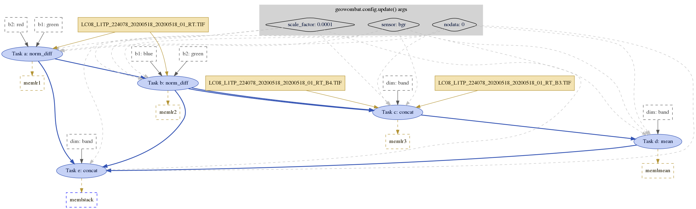
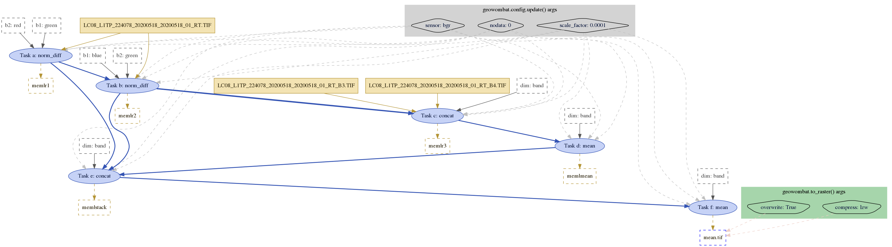
import geowombat as gw
from geowombat.tasks import GeoTask
from geowombat.data import l8_224078_20200518_B3, l8_224078_20200518_B4, l8_224078_20200518

import xarray as xr

# Setup the input steps
inputs = {
    'a': l8_224078_20200518,
    'b': l8_224078_20200518,
    'c': (l8_224078_20200518_B3, l8_224078_20200518_B4),
    'd': 'c',               # the input of 'd' is the output of 'c'
    'e': ('a', 'b', 'd')    # the input of 'e' is the output of 'a', 'b', and 'c'
}

# Setup the outputs of each step
# Here, we could specify filenames to write or to process in-memory
outputs = {
    'a': 'mem|r1',
    'b': 'mem|r2',
    'c': 'mem|r3',
    'd': 'mem|mean',
    'e': 'mem|stack'
}

# Setup the tasks to execute on each input step
tasks = (
    ('a', gw.norm_diff),
    ('b', gw.norm_diff),
    ('c', xr.concat),
    ('d', xr.DataArray.mean),
    ('e', xr.concat)
)

# Setup the function keyword arguments of each step
func_args = {
    'a': {'b1': 'green', 'b2': 'red'},
    'b': {'b1': 'blue', 'b2': 'green'},
    'c': {'dim': 'band'},
    'd': {'dim': 'band'},
    'e': {'dim': 'band'}
}

open_args = {'chunks': 512}
config_args = {'sensor': 'bgr', 'nodata': 0, 'scale_factor': 0.0001}
out_args = {}

# Setup the task object
task_mean = GeoTask(
    inputs,
    outputs,
    tasks,
    config_args=config_args,
    open_args=open_args,
    func_args=func_args,
    out_args=out_args
)

# Visualize the steps
task_mean.visualize()