GeoWombat: Utilities for geospatial data#
Raster & Remotely Sensed Data Made Easy#
GeoWombat provides utilities to process geospatial and time series of raster data at scale. Easily process Landsat, Sentinel, Planetscope or RGB data and others.
Modern satellites like Sentinel-2, Landsat, and PlanetScope give you petabytes of free imagery, but the Python tools for working with it are scattered across many libraries. A typical workflow makes you stitch together rasterio, GDAL, NumPy, xarray, geopandas, and scikit-learn, each with its own rules for coordinate systems, nodata, affine transforms, and chunked computation. GeoWombat gives you a single, high-level API that ties these libraries together behind one consistent interface, so you can process large raster datasets without writing low-level geospatial code, whether you are a GIS professional, a remote sensing scientist, or a machine learning practitioner.
Common Remote Sensing Uses
Simple read/write for a variety of sensors (Landsat, Sentinel etc)
Image mosaicking
On-the-fly image transformations (reprojection)
Point / polygon raster sampling, extraction
Time series analysis
Band math (NDVI, Tasseled cap, EVI etc)
Image classification and regression
Radiometry (BRDF normalization)
Distributed processing
Mosaic Images Example
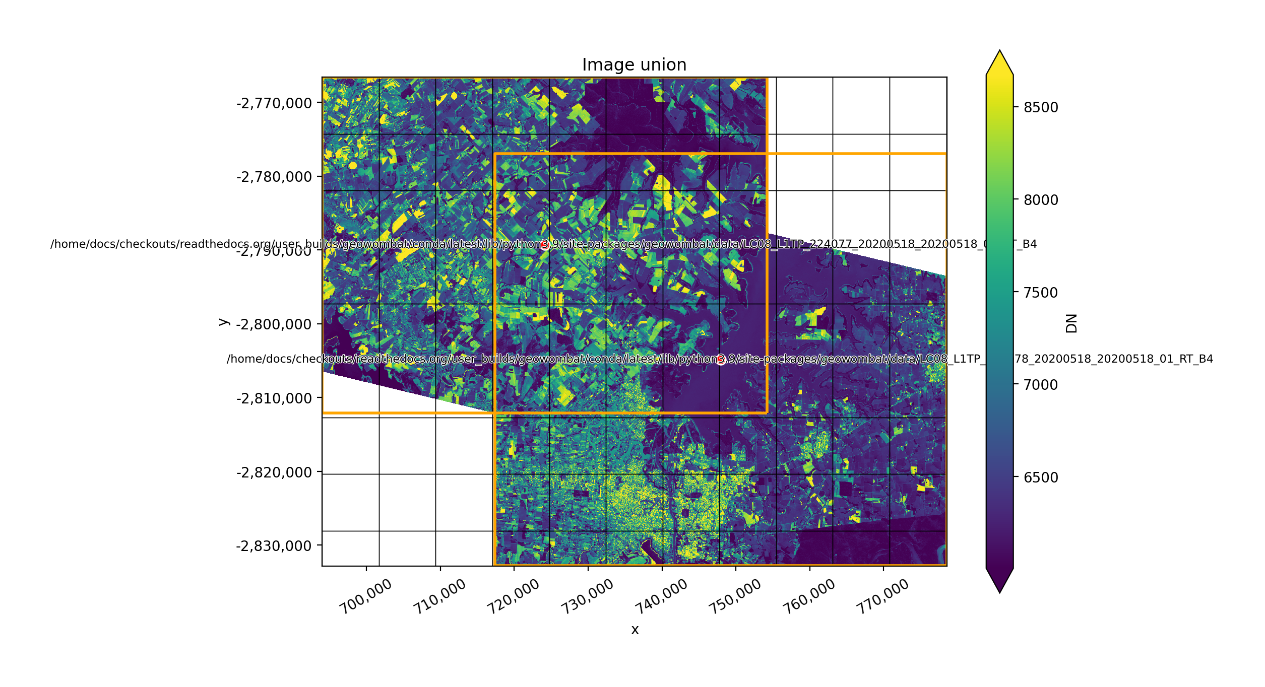
Computation scales easily over large datasets with minimal changes to the code
# Set a reference image to align to
with gw.config.update(ref_image='image_a.tif', sensor='l7'):
    # Open images as Xarray DataArrays
    with gw.open('image_a.tif') as srca, gw.open('image_b.tif') as srcb:
        # The size of srca, srcb, and results are determined
        # by the configuration context
        vis_mean = srcb.sel(band=['blue', 'green', 'red']).mean(dim='band')
        results = srca.sel(band='blue') * vis_mean
        # Initiate computation by writing the results to file
        results.gw.save(
            'output.tif',
            num_workers=4,
            compress='lzw'
        )
For more details, see the tutorials and examples.
The package is inspired by, and built on, several key libraries for large-scale data processing, such as Dask, Geopandas, Pandas, Rasterio, and Xarray. GeoWombat interfaces directly with Xarray for raster I/O, which uses Rasterio to open raster files such as satellite images or aerial photos as Dask arrays. GeoWombat uses the Xarray register to extend the functionality of Xarray DataArrays.
One of the key features of GeoWombat is the on-the-fly handling of multiple files. In particular, GeoWombat leverages Rasterio to transform and align rasters with varying projections and spatial resolutions. In addition to simplifying the process of data alignment, GeoWombat utilizes the task graphs of Dask arrays. By default, GeoWombat loads a raster as a DataArray, which points to the raster data on file using a chunked Dask array. This task graph feature simplifies parallel computations of one or more raster files of any size.